


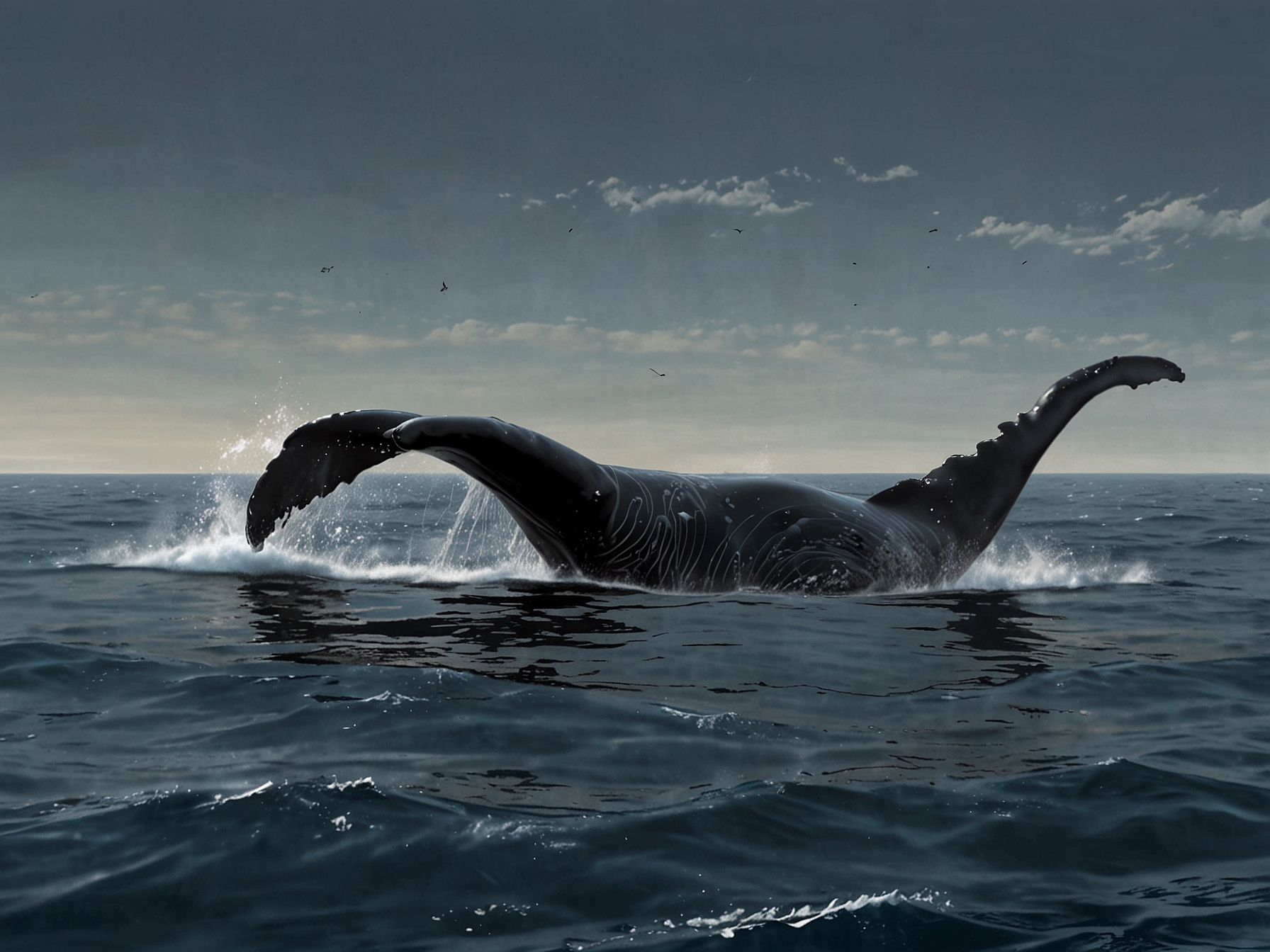
The North Atlantic right whale, one of the most endangered species on the planet, faces numerous threats in the waters off the coast of Canada. These gentle giants, with a population estimated at fewer than 400 individuals, are at significant risk from ship strikes, entanglements in fishing gear, and the increasing impacts of climate change. To combat these threats, a novel approach has been introduced: the utilization of space data. Space-based monitoring systems are revolutionizing the way conservationists and researchers track and protect these magnificent creatures.
© FNEWS.AI – Images created and owned by Fnews.AI, any use beyond the permitted scope requires written consent from Fnews.AI
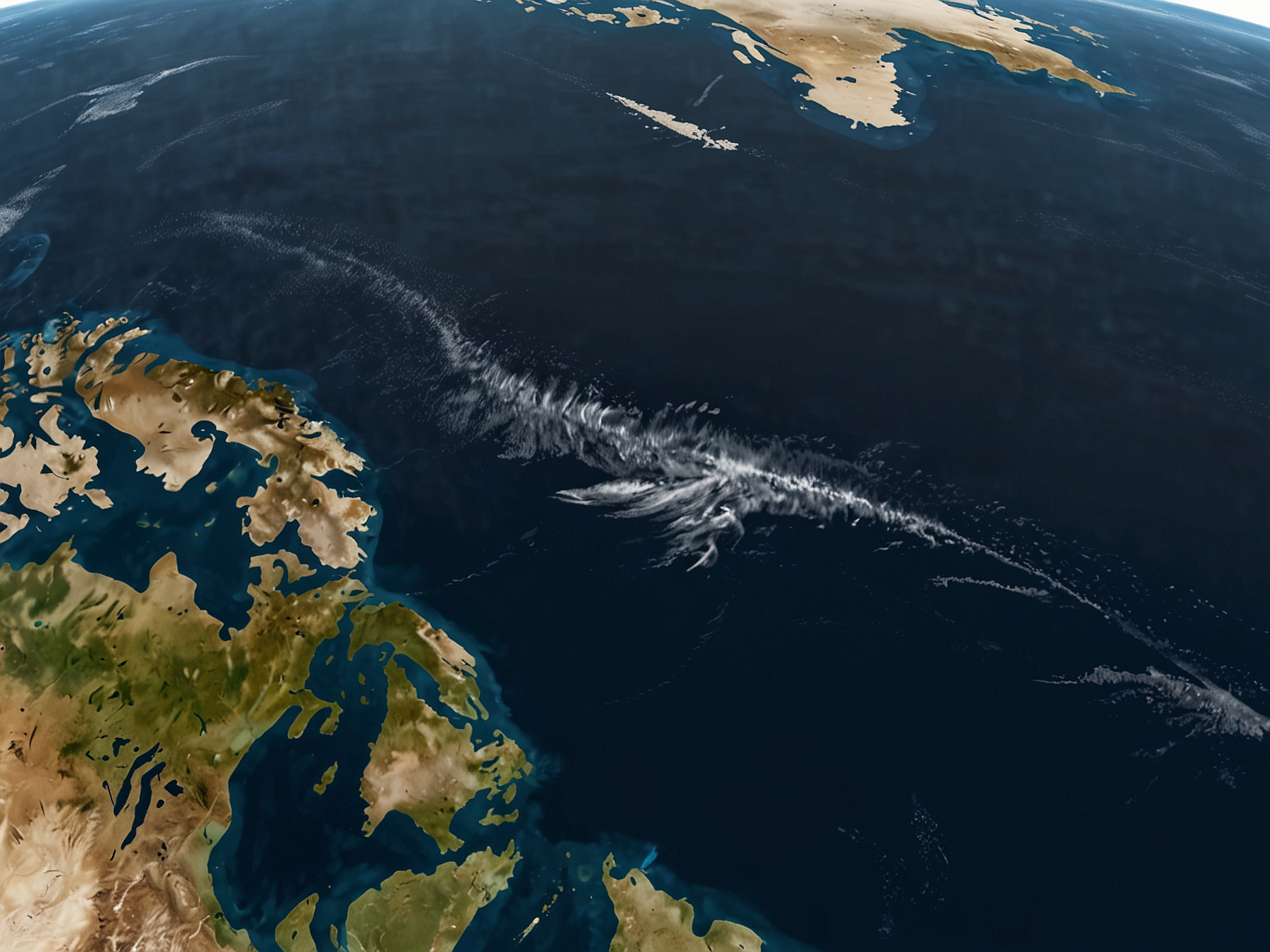
Satellites orbiting Earth are now being employed to gather critical information about the movement and behavior of North Atlantic right whales. These high-tech monitoring systems offer several advantages over traditional methods. For one, they provide a bird’s-eye view of the whales’ habitats, covering large areas that would be impossible to monitor consistently with boats and planes. This real-time data can be pivotal in understanding migration patterns, feeding grounds, and other critical habitats.
One of the primary benefits of using space data is its ability to offer near-instantaneous information. Satellites equipped with advanced sensors can detect changes in the ocean environment, such as water temperature and plankton blooms, which are essential for right whale feeding. By analyzing these variables, researchers can forecast where the whales are likely to be, allowing for more targeted efforts in whale protection. This proactive approach contrasts sharply with earlier, reactive strategies that were often too late to prevent harm to these vulnerable animals.
© FNEWS.AI – Images created and owned by Fnews.AI, any use beyond the permitted scope requires written consent from Fnews.AI
Additionally, satellite data helps identify areas with heavy ship traffic. Ship strikes are a significant threat to North Atlantic right whales, as these massive vessels often cannot detect the whales in time to avoid collisions. By using space data to pinpoint high-risk zones, maritime authorities can implement speed restrictions and other precautionary measures to minimize potential strikes. This collaboration between space technology and marine conservation is a promising step toward reducing human-induced whale fatalities.
The role of satellite data extends beyond just tracking and predicting whale movements. It also plays a crucial role in monitoring environmental changes. The health of the marine ecosystem has a direct impact on the well-being of North Atlantic right whales. For example, changes in sea surface temperature can affect the distribution of zooplankton, the primary food source for these whales. By continuously monitoring these environmental parameters, scientists can gain insights into the broader ecological impacts and take necessary actions to mitigate adverse effects.
Moreover, the integration of space data with other technologies enhances its effectiveness. Drones and underwater acoustic devices complement satellite observations by providing more granular data and real-time audio monitoring of whale vocalizations. This multi-faceted approach ensures a comprehensive understanding of whale behavior and environmental conditions, which is vital for effective conservation measures.
The collaboration between space agencies, marine biologists, and conservation groups underscores the importance of interdisciplinary efforts in tackling complex environmental issues. Canadian waters, known for their rich biodiversity and complex marine environments, present a unique challenge that necessitates innovative solutions. The use of space data marks a significant advancement in marine conservation, ensuring that the efforts to protect the North Atlantic right whales are backed by cutting-edge technology and accurate data.
Despite the promising developments, the deployment of space data for whale conservation is not without its challenges. High-resolution satellite imagery and advanced sensors are costly, and the interpretation of this data requires expertise and sophisticated algorithms. However, the benefits far outweigh these hurdles. Investments in these technologies are investments in the future of not only the North Atlantic right whales but also the overall health of our oceans.
Communities and policymakers have a crucial role to play in ensuring the success of these initiatives. Public awareness and support for the use of space technology in conservation efforts can drive policy changes and increase funding for these innovative approaches. By advocating for the protection of endangered species and the preservation of marine ecosystems, society can help create a sustainable future where technology and nature coexist harmoniously.
In conclusion, the utilization of space data to monitor and protect North Atlantic right whales represents a groundbreaking shift in conservation strategies. These endangered giants, which once faced almost insurmountable threats, now have a fighting chance thanks to the advancements in satellite technology. As we continue to harness the power of space data, our ability to protect and preserve these majestic creatures for future generations will only grow stronger. This blend of innovation, collaboration, and dedication stands as a testament to human ingenuity and our commitment to safeguarding the planet’s natural heritage.
Was this content helpful to you?

